활용사례
| 제목 | Quality Assessment of Four DEMs Generated Using In-Track KOMPSAT-3 Stereo Images | ||
|---|---|---|---|
| 국/내외 | 국내 | 작성일 | 2019-06-18 |
|
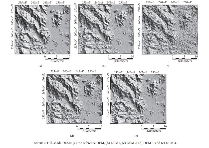
The purpose of this research was to analyze the quality and characteristics of four digital elevation models (DEMs) generated using in-track Korea Multi-Purpose Satellite (KOMPSAT)-3 stereo images. The sensor modeling methods were based on ground control points (GCPs), the initial rational polynomial coefficients (RPCs), relative adjustment, and the automatic bias-compensation method. The GCPs and check points (CPs) were extracted from the 0.25 m aerial orthoimage and the 5 m DEM provided by the National Geographic Information Institute (NGII). The DEMs had the same resolution as the reference DEM (5 m) and comparative analysis was carried out. The results indicate that when relative adjustment was applied alone (DEM 3), the percentage of matched points with a correlation of 0.8 or more was improved by at least 17% compared to the case where only initial RPCs were used (DEM 2). Although the absolute horizontal position error of DEM 3 could not be eliminated, the relative elevation error at the same position was reduced significantly. Therefore, if the relative positions of DEMs produced at different times can be corrected, they can be used for the detection of changes in altitude. When applying the automatic bias-compensation method (DEM 4) without GCPs, the percentage of matched points with a correlation of 0.8 or more was 70.1%. When GCPs were used (DEM 1), the value was 70.2%, i.e., almost identical to that of DEM 4. The mean difference in resolution among DEMs 1 and 4 was -1.8 ± 3.4 m (median, -1.0 m). The results show that DEMs of sufficient quality can be generated without GCPs. Furthermore, although discrepancies among the DEMs were noted in forest and shadow areas, it is possible to produce a 5~10 m resolution DEM by using additional image processing techniques, such as shadow removal. |
|||
| 출처 | Journal of Sensors | ||
| 이전글 | 2019년 5월 미국 제퍼슨시티 토네이도 피해 모습 |
|---|---|
| 다음글 | Two-Dimensional Ship Velocity Estimation Based on KOMPSAT-5 Synthetic Aperture Radar Data |
연관위성영상
-
 미국:자유의 여신상(2023-11-03)
2023-11-14
-
 리비아:데르나 홍수(2023-09-13)
2023-09-18
-
 스페인:홍수(2023-09-06)
2023-09-14
연관활용사례
-
KOMPSAT-3/3A 영상으...
토양
2024-04-19
-
SSResUnet 모델을 이용...
토양
2024-04-19
-
KOMPSAT-3/3A 영상으...
환경
2024-04-16
최신미디어
-
항우연
항우연, 심우주탐사를 위...
2024-03-14
-
항우연
대한민국 최초 달 궤도선...
2024-03-14

네팔:지진(2015-05-05)
| 카테고리 | 재난재해 |
|---|---|
| 위성정보 | KOMPSAT-3 |
| 생성일 | 2015-03-24 |
세부정보
| ProductID | K3_20150505073608_15817_06161210 |
|---|---|
| 국가(영문) | Nepal |
| 국가 | 네팔 |
| 지역 | Pokhara |
| 레벨 | 1R |