활용사례
| 제목 | International Charter: Cyclone Amphan in India | ||
|---|---|---|---|
| 국/내외 | 국외 | 작성일 | 2020-06-01 |
|
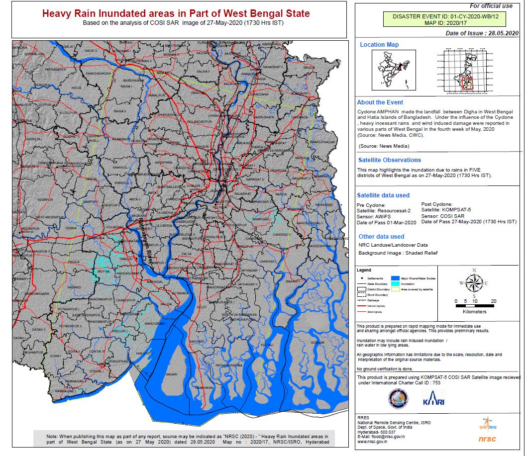
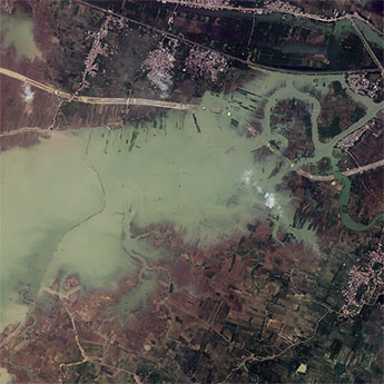
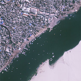
Cyclone Amphan is expected to make landfall in India on 20 May, on the coasts of India and Bangladesh between the Sagar Islands in West Bengal and the Hatiya Islands in Bangladesh. |
|||
| 출처 | International Charter | ||
| 이전글 | KOMPSAT-5 change detection analysis |
|---|---|
| 다음글 | High Accuracy Mosaic Generation Using KOMPSAT-3A Data |
연관위성영상
-
 인도:바갈푸르 홍수(2023-08-29)
2023-10-23
-
 인도:염전(2023-06-09)
2023-07-11
-
 인도:바라나시(2023-02-05)
2023-07-07
연관활용사례
-
Wildfire in Chile
재해
2024-04-04
-
Flooding in Chile
재해
2023-08-17
-
Flash Floods in ...
재해
2023-08-17
최신미디어
-
항우연
항우연, 심우주탐사를 위...
2024-03-14
-
항우연
대한민국 최초 달 궤도선...
2024-03-14

네팔:지진(2015-05-05)
| 카테고리 | 재난재해 |
|---|---|
| 위성정보 | KOMPSAT-3 |
| 생성일 | 2015-03-24 |
세부정보
| ProductID | K3_20150505073608_15817_06161210 |
|---|---|
| 국가(영문) | Nepal |
| 국가 | 네팔 |
| 지역 | Pokhara |
| 레벨 | 1R |