활용사례
| 제목 | Geometric Modeling Accuracy Assessment of KOMPSAT-5 | ||
|---|---|---|---|
| 국/내외 | 국외 | 작성일 | 2020-06-17 |
|
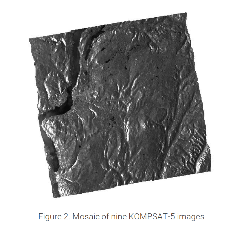
In this study two blocks of KOMPSAT-5 L1A standard mode images were used to study the geometric modeling accuracy of the images both with and without GCPs. The first set is a block of four images of the city of Ottawa, Ontario, Canada. The second set is a block of 9 images of Kelowna, British Columbia, Canada. PCI OrthoEngine software was used to perform the evaluation process. Since KOMPSAT-5 L1A data is distributed with RPCs, RPC geometric modeling method was used for the study. |
|||
| 출처 | SIIS(SI Imaging Services) | ||
| 이전글 | High Accuracy Mosaic Generation Using KOMPSAT-3A Data |
|---|---|
| 다음글 | 원격 탐사 영상을 활용한 CNN 기반의 초해상화 기법 연구 |
연관위성영상
-
 영국:홀리루드 궁전(2022-09-23)
2022-09-28
-
 방글라데시:홍수(2022-07-04)
2022-08-08
-
 필리핀:불루산 볼케이노(2022-06-17)
2022-06-22
연관활용사례
-
KOMPSAT-3와 KOMPS...
토양
2024-04-16
-
Wildfire in Chile
재해
2024-04-04
-
아리랑 위성 5호 SAR 스테...
지리
2024-03-15
최신미디어
-
항우연
항우연, 심우주탐사를 위...
2024-03-14
-
항우연
대한민국 최초 달 궤도선...
2024-03-14

네팔:지진(2015-05-05)
| 카테고리 | 재난재해 |
|---|---|
| 위성정보 | KOMPSAT-3 |
| 생성일 | 2015-03-24 |
세부정보
| ProductID | K3_20150505073608_15817_06161210 |
|---|---|
| 국가(영문) | Nepal |
| 국가 | 네팔 |
| 지역 | Pokhara |
| 레벨 | 1R |