활용사례
| 제목 | International Charter:Flood situation in the Philippines | ||
|---|---|---|---|
| 국/내외 | 국외 | 작성일 | 2022-04-27 |
|
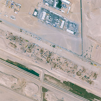
Tropical Storm Megi (also known as Agaton) passed over the Philippines on 10 April, causing landslides and floods in its wake.
※ 원문은 출처를 통해 확인할 수 있습니다. |
|||
| 출처 | International Charter | ||

| 이전글 | 농경지 관측을 위한 KOMPSAT 대기보정 적용 및 평가 |
|---|---|
| 다음글 | Derivation of Surface Temperature from KOMPSAT-3A Mid-wave Infrared Data Using a Radiative Transfer Model |
연관위성영상
-
 사우디아라비아:더 라인(2023-02-18)
2023-08-25
-
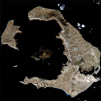 그리스 공화국:산토리니 섬(2022-11-24)
2022-12-05
-
 필리핀:태풍으로 인한 홍수(2022-09-01)
2022-11-07
연관활용사례
-
Wildfire in Chile
재해
2024-04-04
-
Flooding in Chile
재해
2023-08-17
-
Flash Floods in ...
재해
2023-08-17
최신미디어
-
항우연
항우연, 심우주탐사를 위...
2024-03-14
-
항우연
대한민국 최초 달 궤도선...
2024-03-14

네팔:지진(2015-05-05)
| 카테고리 | 재난재해 |
|---|---|
| 위성정보 | KOMPSAT-3 |
| 생성일 | 2015-03-24 |
세부정보
| ProductID | K3_20150505073608_15817_06161210 |
|---|---|
| 국가(영문) | Nepal |
| 국가 | 네팔 |
| 지역 | Pokhara |
| 레벨 | 1R |