활용사례
| 제목 | Multi-temporal Analysis of Deforestation in Pyeongyang and Hyesan, North Korea | ||
|---|---|---|---|
| 국/내외 | 국내 | 작성일 | 2016-11-25 |
|
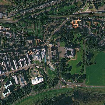
Since forest is an important part of ecological system, the deforestation is one of global substantive issues. It is generally accepted that the climate change is related to the deforestation. The issue is worse in developing countries because the forest is one of important natural resources. In the case of North Korea, the deforestation is on the rise from forest reclamation for firewood collection and food production. Moreover, a secondary effect from flood intensifies the damage. Also, the political situation in North Korea presents difficulty to have in-situ measurements. It means that the accurate information of North Korea is nearly impossible to obtain. Thus, assessing the current situation of the forest in North Korea by indirect method is required. The objective of this study is to monitor the forest status of North Korea using multitemporal Landsat images, from 1980s to 2010s. Since the deforestation in North Korea is caused by local residents, we selected two study areas of high population density: Pyeongyang and Hyesan. In North Korea, most of clean Landsat images are acquired in fall season. The fall images have an advantage that we can easily distinguish agriculture areas from forest areas, also have an disadvantage that the forests cannot be easily identified because some of trees have turned red. To identify the forests exactly, we proposed a modified Normalized Difference Vegetation Index (mNDVI) value. The deforestation in Pyeongyang and Hyesan was analyzed by using mNDVI. The dimension of forest has decreased approximately 36% in Pyeongyang for 27 years and approximately 25% in Hyesan for 16 years. The results show that the forest areas in Pyeongyang and Hyesan have been steadily reduced. |
|||
| 출처 | 대한원격탐사학회지(KoreaScience 제공) | ||

| 이전글 | MODIS 위성영상을 이용한 임상정보의 추출 |
|---|---|
| 다음글 | 위성정보를 활용한 시·공간적으로 분포되어 있는 토양수분산정 및 활용방안 |
연관위성영상
-
 영국:홀리루드 궁전(2022-09-23)
2022-09-28
-
 뉴질랜드:해글리 파크 노스(2022-05-28)
2022-06-02
-
 시리아:시리아의 요새(2022/5/10 )
2022-07-06
연관활용사례
-
다목적실용위성 3A 영상정보의...
지리
2024-05-13
-
KOMSPAT-3 광학 영상과...
토양
2024-05-10
-
The Impact of GC...
해양
2024-05-10
최신미디어
-
과기정통부
국내 최초 양산형 초소형...
2024-04-26
-
과기정통부
초소형군집위성 1호 발사...
2024-04-24

네팔:지진(2015-05-05)
| 카테고리 | 재난재해 |
|---|---|
| 위성정보 | KOMPSAT-3 |
| 생성일 | 2015-03-24 |
세부정보
| ProductID | K3_20150505073608_15817_06161210 |
|---|---|
| 국가(영문) | Nepal |
| 국가 | 네팔 |
| 지역 | Pokhara |
| 레벨 | 1R |