활용사례
| 제목 | International Charter : Hurricane Maria in the Caribbean | ||
|---|---|---|---|
| 국/내외 | 국외 | 작성일 | 2017-09-25 |
|
Hurricane Maria, a Category Five storm, is moving through the Caribbean Islands. The storm follows in the wake of Hurricane Irma and has affected some of the same countries, with devastating results to some of the islands. |
|||
| 출처 | Internationcal Charter | ||

| 이전글 | 세인트마틴 섬의 허리케인 어마(Hurricane Irma) 전후 비교 |
|---|---|
| 다음글 | 2017년 10월 캘리포니아 산타로사 화재 전후 비교 |
연관위성영상
-
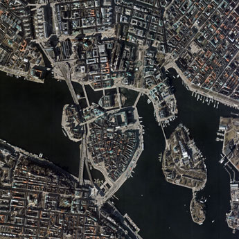 스웨덴:The Royal Palace(2025-03-19)
2025-06-09
-
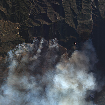 미국:LA 산불(2025-01-09)
2025-01-31
-
 사우디아라비아:더 라인(2023-02-18)
2023-08-25
연관활용사례
-
Applicability of...
환경
2025-07-07
-
Lake detection a...
환경
2025-07-01
-
Flood in Brazil
재해
2025-06-26
최신미디어
-
과기정통부
47m 누리호, 우주의 ...
2025-05-29
-
항우연
한국항공우주연구원 홈페이...
2025-05-16

네팔:지진(2015-05-05)
| 카테고리 | 재난재해 |
|---|---|
| 위성정보 | KOMPSAT-3 |
| 생성일 | 2015-03-24 |
세부정보
| ProductID | K3_20150505073608_15817_06161210 |
|---|---|
| 국가(영문) | Nepal |
| 국가 | 네팔 |
| 지역 | Pokhara |
| 레벨 | 1R |