활용사례
| 제목 | Detection of illegal constructions in urban cities: comparing LIDAR data and stereo KOMPSAT-3 images with development plans | ||
|---|---|---|---|
| 국/내외 | 국외 | 작성일 | 2020-03-04 |
|
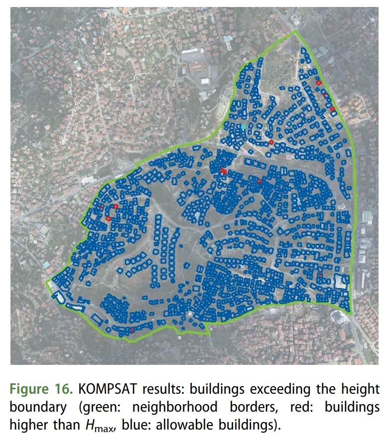
Illegal building construction can be a problematic issue on densely populated metropolitan cities, especially because it leads to crooked civilization and unbalanced urban structure. The development plans define a maximum boundary for building coverage and floor ratios, but practically it is challenging to apply the plans to the real life in partly unplanned cities that are going under urban transformation, such as Istanbul. Rapidly changing settlements make it crucial to track property statuses carefully since there can be juristic consequences. In this study, we use airborne Light Detection and Ranging (LIDAR) point cloud data, stereo KOMPSAT-3 images and development plans of Guzeltepe district, locating in Uskudar/Istanbul of Turkey to detect the structures built against the development plans. The plans were converted into aGeographical Information System (GIS) environment for the ease of analysis. Digital elevation models and digital surface models (DSMs) were created with both LIDAR and stereo KOMPSAT-3 data to obtain normalized DSMs for extracting the heights of the buildings. These heights extracted from our models were then compared with the planned boundaries. Also, the two different dataset’s accuracies were analyzed. Our research may have direct implications on automatically building 3D plans and eventually instrumental for identification of illegal buildings. |
|||
| 출처 | EUROPEAN JOURNAL OF REMOTE SENSING | ||
| 이전글 | 세분류 토지피복지도 현행화 구축(9차) |
|---|---|
| 다음글 | 위성영상 지상위치관측 시스템의 정확도 분석 |
연관위성영상
-
 미국:자유의 여신상(2023-11-03)
2023-11-14
-
 리비아:데르나 홍수(2023-09-13)
2023-09-18
-
 스페인:홍수(2023-09-06)
2023-09-14
연관활용사례
-
KOMPSAT-3/3A 영상으...
토양
2024-04-19
-
SSResUnet 모델을 이용...
토양
2024-04-19
-
KOMPSAT-3/3A 영상으...
환경
2024-04-16
최신미디어
-
과기정통부
국내 최초 양산형 초소형...
2024-04-26
-
과기정통부
초소형군집위성 1호 발사...
2024-04-24

네팔:지진(2015-05-05)
| 카테고리 | 재난재해 |
|---|---|
| 위성정보 | KOMPSAT-3 |
| 생성일 | 2015-03-24 |
세부정보
| ProductID | K3_20150505073608_15817_06161210 |
|---|---|
| 국가(영문) | Nepal |
| 국가 | 네팔 |
| 지역 | Pokhara |
| 레벨 | 1R |