활용사례
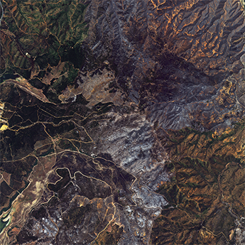
| 제목 | Wildfire in Chile | ||
|---|---|---|---|
| 국/내외 | 국외 | 작성일 | 2024-04-04 |
|
Wildfires spread across central Chile on 03 February, mainly affecting the region of Valparaíso. At least 3,000 homes have been destroyed and the current death toll is 123. Rescue teams fear this number will rise as relief operations continue. |
|||
| 출처 | International Charter | ||

| 이전글 | 다종 위성영상 자료 융합 기반 수자원 모니터링 기술 개발 |
|---|---|
| 다음글 | KOMPSAT-3/3A 영상으로부터 딥러닝 모델을 활용한 굴뚝 탐지 및 크기 추정 |
연관위성영상
-
 칠레:칠레 발파라조 산불(2024-02-06)
2024-05-21
-
 칠래:산티아고(2023-06-13)
2023-07-11
-
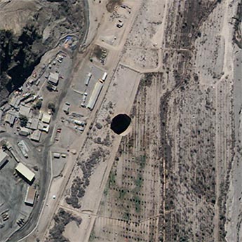 칠레:싱크홀(2022-08-20)
2022-08-23
연관활용사례
-
Real-Time Wildfi...
환경
2025-07-14
-
Applicability of...
환경
2025-07-07
-
Lake detection a...
환경
2025-07-01
최신미디어
-
과기정통부
47m 누리호, 우주의 ...
2025-05-29
-
항우연
한국항공우주연구원 홈페이...
2025-05-16

네팔:지진(2015-05-05)
| 카테고리 | 재난재해 |
|---|---|
| 위성정보 | KOMPSAT-3 |
| 생성일 | 2015-03-24 |
세부정보
| ProductID | K3_20150505073608_15817_06161210 |
|---|---|
| 국가(영문) | Nepal |
| 국가 | 네팔 |
| 지역 | Pokhara |
| 레벨 | 1R |