활용사례
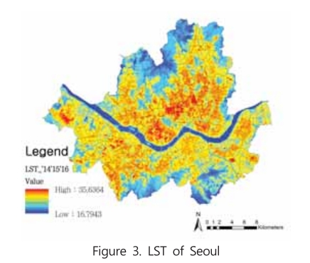
| 제목 | 서울시 주거지역의 건축물 면적 비율에 따른 여름철 주간 지표면온도 영향 분석 | ||
|---|---|---|---|
| 국/내외 | 국내 | 작성일 | 2017-06-28 |
|
In this study, Urban Heat Island(UHI) effects of Seoul were spatially analyzed with building characteristics of urban areas. Ground Coverage Ratio(GCR) was adopted to represent urban building characteristics of Seoul. GCR stands for coverage ratio of building in a unit grid which is 30m in this study. Afterward, Land Surface Temperature(LST) derived from satellite remote sensing image was used as an indicator for UHI of Seoul. Furthermore, for more precise analysis, residential areas near cool islands such as mountains, large green spaces, river were removed from analysis area in order to analyze independent effect of structural characteristics with LST. To build up GCR, 2015 Seoul building data provided by Ministry of Land, Infrastructure, and Transport was used. For thermal index, time series Landsat8 images of 2014-2016 summer were used to derive 3 year average LST of Seoul. Statistical analysis between two indices showed strong linear relationship between LST and GCR. |
|||
| 출처 | 국토계획 | ||
| 이전글 | 세분류 토지피복지도 구축(7차) 및 국가환경지도시스템 기능개선 |
|---|---|
| 다음글 | 겨울철 동해상에서 대상수렴운이 발달하는 과정과 영동지역의 강설에 미치는 영향에 관한 연구 |
연관위성영상
-
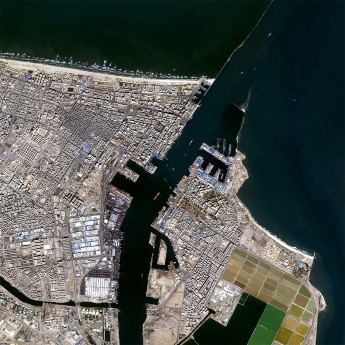 이집트:수에즈 운하(2016-08-10)
2017-09-19
-
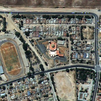 탄자니아:건축물/Gadaffi 모스크(2015-07-28)
2017-05-19
-
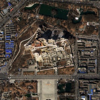 중국:건축/포탈라궁(2015-02-26)
2017-05-31
연관활용사례
-
KOMPSAT-3/3A 영상으...
토양
2024-04-19
-
KOMPSAT-3/3A 영상으...
환경
2024-04-16
-
KOMPSAT-3/3A 영상 ...
해양
2023-12-04
연관미디어
-
항우연
누리호 3차 발사 비행정...
2023-06-26
-
항우연
누리호 3차 발사 중간 ...
2023-05-31

네팔:지진(2015-05-05)
| 카테고리 | 재난재해 |
|---|---|
| 위성정보 | KOMPSAT-3 |
| 생성일 | 2015-03-24 |
세부정보
| ProductID | K3_20150505073608_15817_06161210 |
|---|---|
| 국가(영문) | Nepal |
| 국가 | 네팔 |
| 지역 | Pokhara |
| 레벨 | 1R |