활용사례
| 제목 | A study of the feasibility of using KOMPSAT-5 SAR data to map sea ice in the Chukchi Sea in late summer | ||
|---|---|---|---|
| 국/내외 | 국내 | 작성일 | 2017-09-20 |
|
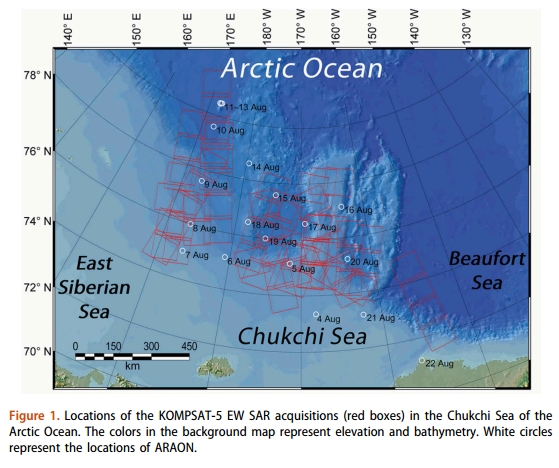
In this study, a sea ice mapping model based on Random Forest (RF), a rule-based machine learning approach, has been developed for the Korea Multi-Purpose Satellite-5 (KOMPSAT-5) Synthetic Aperture Radar (SAR) data in Enhanced Wide swath mode obtained from 6 August to 9 September 2015 in the Chukchi Sea. A total of 12 texture features derived from backscattering intensity and the gray-level co-occurrence matrix were used as input variables for sea ice mapping. The RF model produced a sea ice map with a grid spacing of 125 m, demonstrating excellent performance in the classification of sea ice and open water with an overall accuracy of 99.2% and a kappa coefficient of 98.5%. Sea ice concentration (SIC) retrieved from the RF-derived sea ice maps was compared with that from ice charts. The mean and median values of the differences between the SICs derived from the RF model and the ice charts were −8.85% and −8.38%, respectively. Such difference was attributed to both the uncertainty in the ice charts and classification error of the RF model. |
|||
| 출처 | Remote sensing letters | ||
연관위성영상
-
 미국:자유의 여신상(2023-11-03)
2023-11-14
-
 리비아:데르나 홍수(2023-09-13)
2023-09-18
-
 스페인:홍수(2023-09-06)
2023-09-14
연관활용사례
-
항공영상을 이용한 다목적실용위...
지리
2024-04-24
-
다목적실용위성 6호 수신처리시...
지리
2024-04-24
-
KOMPSAT-3/3A 영상으...
토양
2024-04-19
연관미디어
-
항우연
천리안위성 2A호, 스마...
2019-07-25
-
항우연
천리안위성 2A호가 최초...
2019-02-07

네팔:지진(2015-05-05)
| 카테고리 | 재난재해 |
|---|---|
| 위성정보 | KOMPSAT-3 |
| 생성일 | 2015-03-24 |
세부정보
| ProductID | K3_20150505073608_15817_06161210 |
|---|---|
| 국가(영문) | Nepal |
| 국가 | 네팔 |
| 지역 | Pokhara |
| 레벨 | 1R |