활용사례
| 제목 | International Charter: Flood in Iraq | ||
|---|---|---|---|
| 국/내외 | 국외 | 작성일 | 2019-04-24 |
|
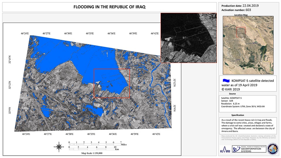
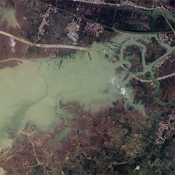
Torrential rain has caused widespread flooding in Iraq. Thousands of people have been forced to evacuate their homes. |
|||
| 출처 | International Charter | ||
| 이전글 | 모잠비크 부지(Buzi) 지역의 사이클론 이다이 피해 모습 |
|---|---|
| 다음글 | 객체 분석을 위한 KOMPSAT-5 영상의 해상도 향상 성능 분석 |
연관위성영상
-
 스페인:홍수(2023-09-06)
2023-09-14
-
 인도:바갈푸르 홍수(2023-08-29)
2023-10-23
-
 이탈리아:체세나 홍수(2023-05-23)
2023-06-08
연관활용사례
-
Wildfire in Chile
재해
2024-04-04
-
Flooding in Chile
재해
2023-08-17
-
Flash Floods in ...
재해
2023-08-17
최신미디어
-
과기정통부
국내 최초 양산형 초소형...
2024-04-26
-
과기정통부
초소형군집위성 1호 발사...
2024-04-24

네팔:지진(2015-05-05)
| 카테고리 | 재난재해 |
|---|---|
| 위성정보 | KOMPSAT-3 |
| 생성일 | 2015-03-24 |
세부정보
| ProductID | K3_20150505073608_15817_06161210 |
|---|---|
| 국가(영문) | Nepal |
| 국가 | 네팔 |
| 지역 | Pokhara |
| 레벨 | 1R |