활용사례
| 제목 | Typhoon Doksuri in China | ||
|---|---|---|---|
| 국/내외 | 국외 | 작성일 | 2023-08-17 |
|
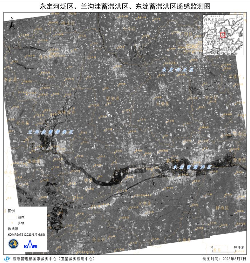
Typhoon Doksuri made landfall in the Fujian province of south-east China on the 28 July. The second of two severe typhoons in recent weeks, Typhoon Doksuri brought gusts of wind over 100 mph and caused widespread flooding and subsequent landslides. |
|||
| 출처 | International Charter | ||
| 이전글 | Incremental Learning with Neural Network Algorithm for the Monitoring Pre-Convective Environments Using Geostationary Imager |
|---|---|
| 다음글 | 심층신경망과 천리안위성 2A호를 활용한 지상기온 추정에 관한 연구 |
연관위성영상
-
 중국:Kumtag 사막(2023-06-10)
2023-07-11
-
 중국:무지개산(2023-06-09)
2023-08-04
-
 중국:정저우 시(2023-04-25)
2023-06-09
연관활용사례
-
Wildfire in Chile
재해
2024-04-04
-
Flooding in Chile
재해
2023-08-17
-
Flash Floods in ...
재해
2023-08-17
최신미디어
-
과기정통부
국내 최초 양산형 초소형...
2024-04-26
-
과기정통부
초소형군집위성 1호 발사...
2024-04-24

네팔:지진(2015-05-05)
| 카테고리 | 재난재해 |
|---|---|
| 위성정보 | KOMPSAT-3 |
| 생성일 | 2015-03-24 |
세부정보
| ProductID | K3_20150505073608_15817_06161210 |
|---|---|
| 국가(영문) | Nepal |
| 국가 | 네팔 |
| 지역 | Pokhara |
| 레벨 | 1R |